Nature in the City Map

Nature in the City Map
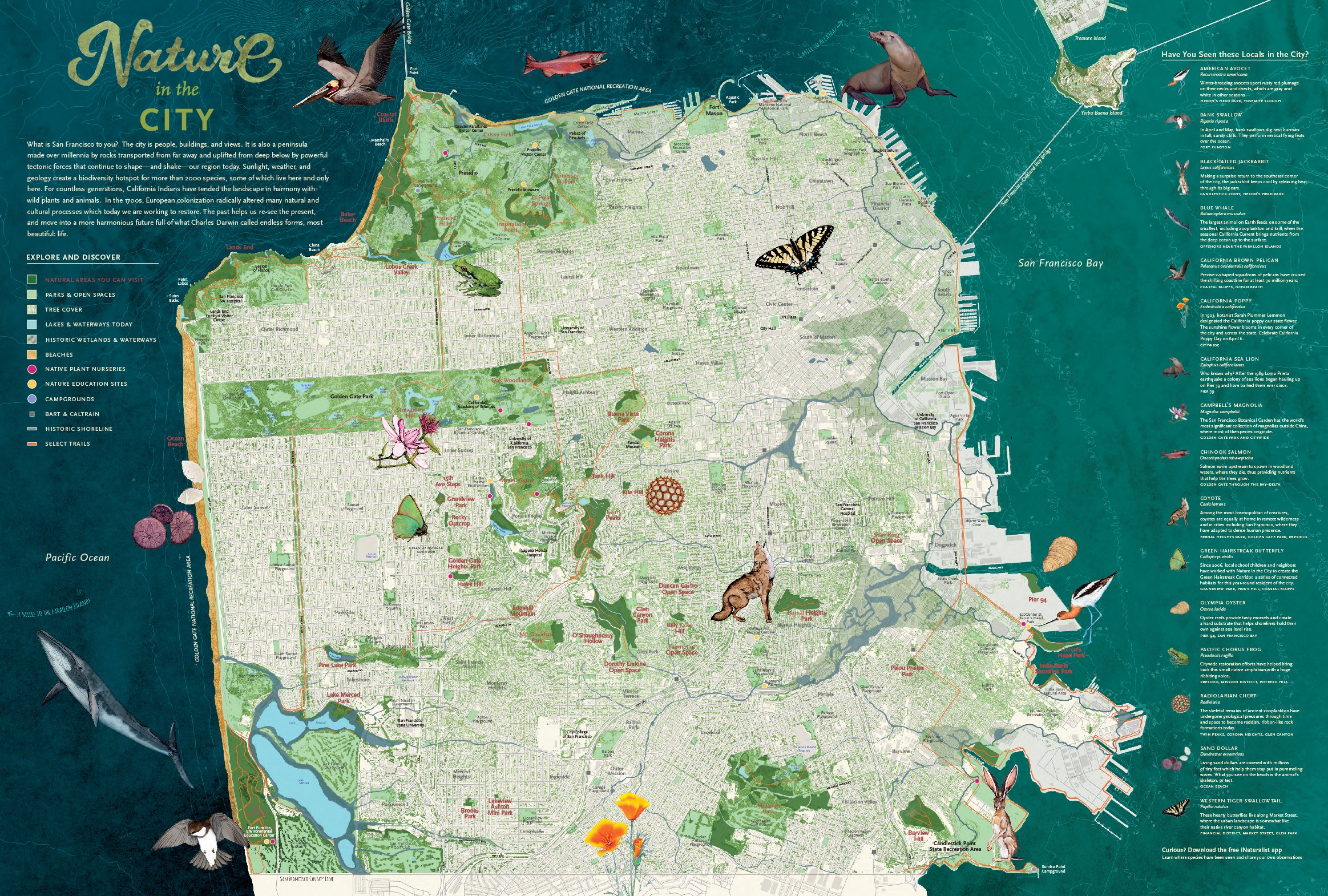
This third edition 2018 map tells stories of earth-shaking forces, charismatic species, and changing urban habitats in San Francisco, woven together with original artwork and design by Jane Kim, Mary Ellen Hannibal, and Leah Elamin. Framed, the map is a beautiful focal point for your home or office. A must-have for anyone who loves to discover and rediscover nature in the city.
Folded Map (8" x 6") — $9.50
Poster Map (24" x 36") — $15.00
Prices include shipping but not sales tax.
If you're interested in selling our maps, please contact us with the subject line "Wholesale Maps" at info@natureinthecity.org.
With layers of information about the biodiversity shaping San Francisco, our map invites you to be curious about nature right outside your door.
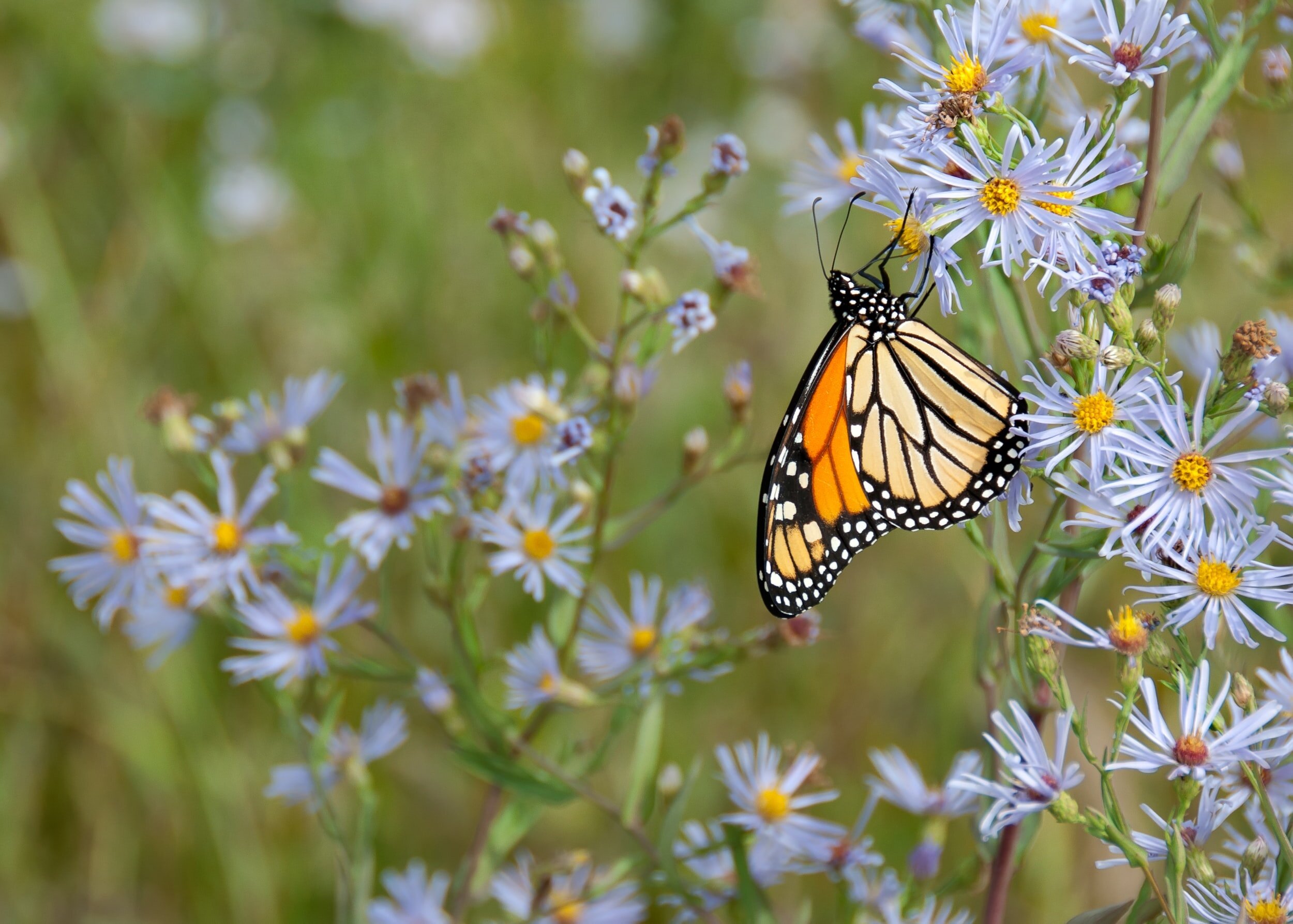
Right here in San Francisco, there is an abundance of nature and unique ecosystems. Highlighting trails, natural areas, and local species of the San Francisco Peninsula, the map is both artistic and scientific.
Learn the stories of earth-shaking forces, charismatic species, and changing urban habitats. In our rapidly developing city, the need for a human and nature connection has never been more acute — now you can easily make that connection.

Take the map with you on your next walk and explore all the interconnected wonders that make up San Francisco.
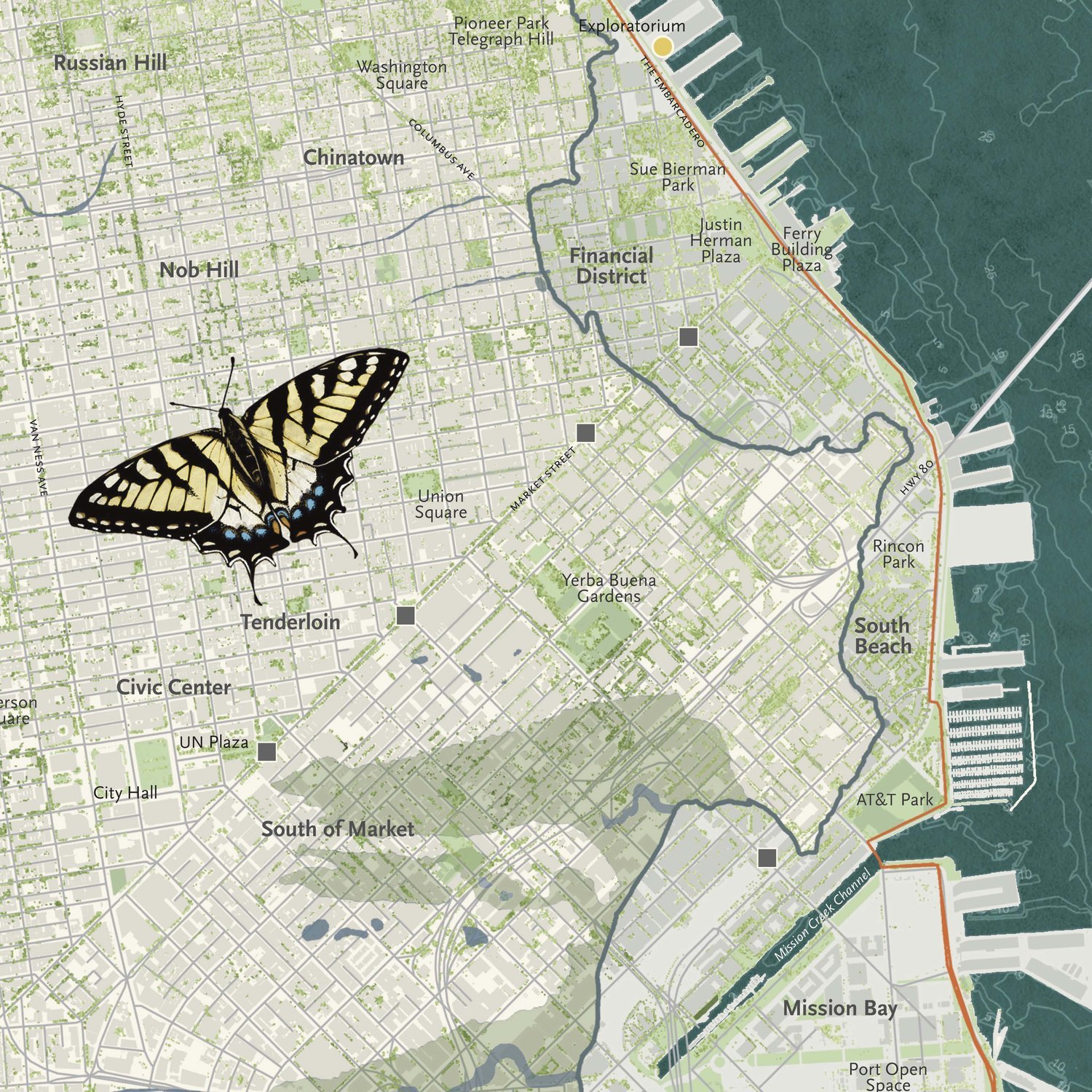
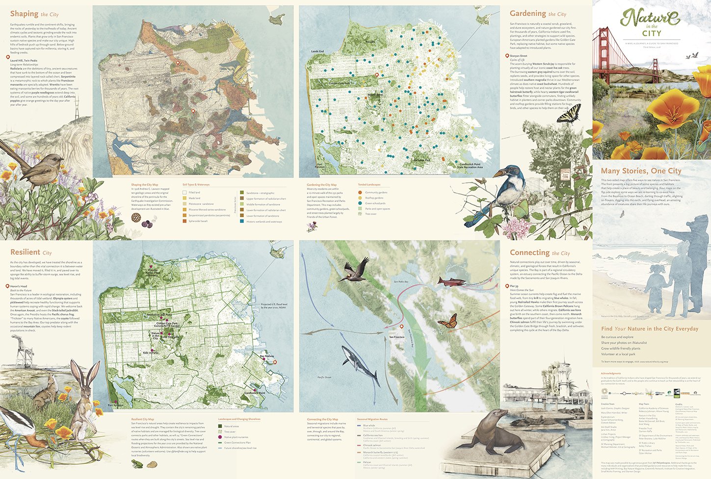
One side of the map shows the whole city, and the flip side hones in on local, regional, continental, and global details across space and time. Four distinct panels tell San Francisco's story through the lens of geology, habitat restoration, history, and interconnections.
San Francisco's historic boundaries and underwater topography are intricately detailed and each illustration is drawn with scientific precision and placed next to where you might find the depicted species in San Francisco.
The Nature in the City Map was a labor of love with our community.
We consulted our community to learn how to make the map useful. The feedback we received was instrumental in developing the Nature in the City Map. The Nature in the City Map is the final product of a three-year, multi-agency collaboration.
On the map, we're delighted to feature original artwork by Jane Kim, writing by Mary Ellen Hannibal, and design by Leah Elamin.
Thanks to Susan Schwarzenberg, Lindsey Irving, and Michael Webster for further creative collaboration.
For map design, we thank, Rebecca Johnson and Alison Young, Amber Hasselbring, Bette McDonnell, Bill Brick, Ariel Wang, Damien Raffa, Peter Brastow, and Luke Walcher, Kelley Trahan, and Dylan Molnar.


This map was made possible by a generous grant from EJF Philanthropies. Additional thanks go to the many individuals and organizations that provided guidance and resources to help make the map, including AMP Printing, Bay Nature Magazine, GreenInfo Network, Institute for Creative Integration, SmallWorks Framing, and Stamen Design.
Credits
Andrew C. Lawson. 1908. Geological Map of San Francisco, David Ramsey Historical Map Collection.
All city and street-related data, SF Planning Department.
Current open water, reservoirs, historic wetlands, waterways, SF Department of Public Works, SFEI, Seep City Water History Map, Joel Pomerantz. Published by Thinkwalks, 2017.
Natural Areas, Parks and Open Spaces, SF Department of the Environment, and SF Recreation and Parks Department.
Connecting the City terrain map, Stamen Design.
Nature in the City Map branding and product marketing, Nature in the City, Ariel Wang.